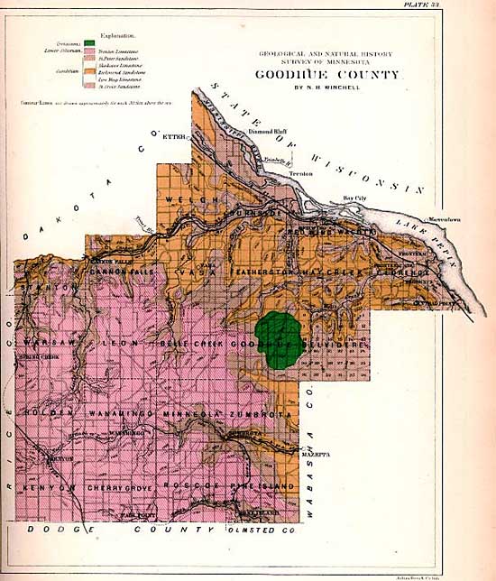
Title: Map of Goodhue County Type:Map Date: 1888 Source: Minnesota Historical Society
Description: This map was published in 1888 in the book Geology of Minnesota.
Activities:
This map shows a dark green area near the center right of Goodhue County. The key in the upper left says that the area is "Cretaceous." What do you think this could mean?
Look at the Mississippi River on the map. Why do you think Red Wing was a good location for a town on this river? (Red Wing is located beneath the "W" in the word "Wisconsin" on this map.)
There are some black lines on this map that intersect near Red Wing. These lines show another form of transportation that was used at this time. What kind of transportation might this be?
The map of the county is divided up into smaller square-shaped sections that are named. What do you think these squares represent?