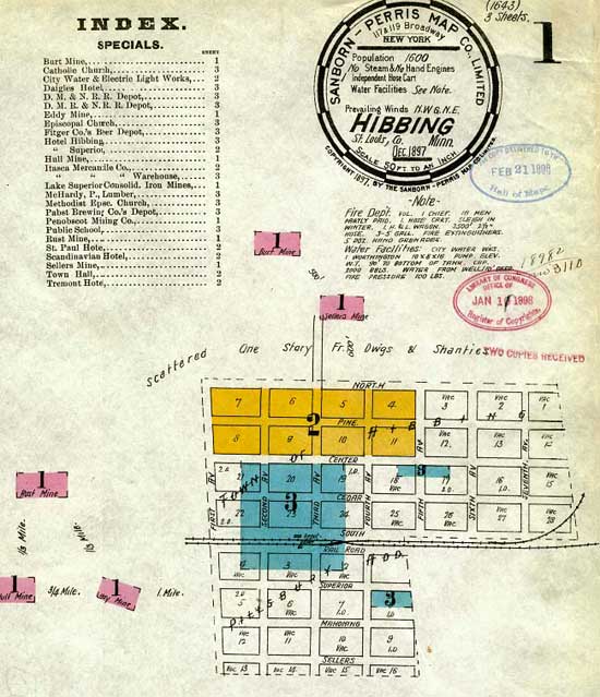
Title: Map of a Section of Old Hibbing Type:Map Date: 1897 Source: Minnesota Historical Society
Description: This map shows part of the old town site of Hibbing in 1897.
Activities:
The key tells you that every inch equals 50 feet. Does it matter if the electronic map you're viewing has been shrunk to fit your screen?
The key also identifies one independent hose cart, the prevailing wind directions, and has a note discussing water facilities. Who would you guess then that this map was made for?
What kinds of buildings could you find in this part of Hibbing?
What do the numbers between the mines tell you about them?